How did Saurav Das fly a drone in a high-security, no-drone area? What are red zones and how CJP’s action was illegal
At around 10 am, a drone shot showed Jantar Mantar packed with protesters responding to the Cockroach Janta Party’s (CJP) “Sansad Chalo” call ahead of the proposed march towards Parliament. Notably, Delhi Police did not grant permission for the protest. The aerial footage captured the gathering from above and was circulated to demonstrate the number of people who had assembled at the protest venue. Source: CJP/X Another video was shared at around 1 pm. Source: CJP/X Another video was shared by CJP’s spokesperson Saurav Das at around 2:30 pm. The video shared by Das was also shared with national and international media houses, and was further amplified through their social media handles. However, the footage has also raised serious questions over the legality of the drone flight. Source: RT India/X A check of the Government of India’s Digital Sky airspace map shows Jantar Mantar inside multiple red zones. Under the Drone Rules, 2021, no person can operate a drone in a red zone without prior permission. A red zone is the most restricted category on the map, and drone operations inside it can be permitted only by the Central Government. Any unauthroised drone flight in red zone is a serious national security concern. The black pin on the map is the location of Jantar Mantar. As depicted by the circles around it, the location falls under multiple red zones. Source: Digital Sky Therefore, unless the operator had secured prior permission from the Central Government, the drone used to capture the CJP protest footage was flown illegally. The question for CJP and the person who recorded or uploaded the footage is straightforward, that is, who authorised the drone flight over Jantar Mantar, and under which Central Government permission was it conducted? Considering that CJP did not seek permission for the protest, it is hard to believe that the person who operated the drone had obtained permission to fly it in the restricted area. Jantar Mantar falls inside a red zone According to the Drone Rules, 2021, the remote pilot is required to verify the flight path on the Digital Sky platform before commencing any flight. The pilot must check whether any notification or restriction applies to the intended area of operation. According to Rule 22 of the Drone Rules, no person can operate an unmanned aircraft system in a red or yellow zone without permission. Only a flight conducted in a green zone is exempt from prior permission, and even there, the pilot is required to verify the latest restrictions before taking off. For those who are unfamiliar with the zoning mechanism, it must be understood that it is not fixed. The zoning is dynamic, and the Central Government can update the Digital Sky map and change the status of an area when and where required. This means an operator cannot rely on an old map, a previous flight or an assumption that a location is open for drones. The map must be checked before every flight. The Ministry of Civil Aviation describes a red zone as a “no-drone zone”. According to the ministry, drones can be operated in such an area only after obtaining permission from the Central Government. The ministry also says that anyone planning a drone operation must check the latest Digital Sky map for changes in zone boundaries. The purpose of the flight does not alter the restriction. A drone does not become exempt merely because it is being used for protest publicity, photography, journalism, social media content or recreational recording. Similarly, keeping the drone at a relatively low altitude does not make the operation legal. Once the location is marked as a red zone, prior Central Government permission is required for the flight itself. What green, yellow and red zones mean The Digital Sky airspace map divides India’s airspace into green, yellow and red zones. The colours determine whether prior permission is needed and which authority is competent to issue it. How Red, Yellow, and Green Zones appear on the map. Source: Digital Sky Green zone A green zone generally covers airspace up to 400 feet, or 120 metres, above an area that has not been designated as yellow or red. There is a separate height restriction near operational airports. In an area situated between 8 kilometres and 12 kilometres from an operational airport’s perimeter, only airspace up to 200 feet, or 60 metres, is treated as green. Prior flight permission is not required in a green zone. However, this does not mean that all other regulations disappear. The drone may still need registration, the operator may need a remote pilot certificate, and the pilot must check the Digital Sky map before the flight. Yellow zone A yellow zone is restricted airspace where drone operations require prior permission from the concerned Air Traffic Control authority. Depending on the airspace, the competent authority may be the Airports Authority of India, the Indian Ai
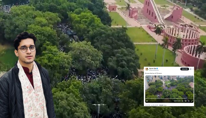
At around 10 am, a drone shot showed Jantar Mantar packed with protesters responding to the Cockroach Janta Party’s (CJP) “Sansad Chalo” call ahead of the proposed march towards Parliament. Notably, Delhi Police did not grant permission for the protest. The aerial footage captured the gathering from above and was circulated to demonstrate the number of people who had assembled at the protest venue.
Source: CJP/X
Another video was shared at around 1 pm.
Source: CJP/X
Another video was shared by CJP’s spokesperson Saurav Das at around 2:30 pm.
The video shared by Das was also shared with national and international media houses, and was further amplified through their social media handles. However, the footage has also raised serious questions over the legality of the drone flight.
Source: RT India/X
A check of the Government of India’s Digital Sky airspace map shows Jantar Mantar inside multiple red zones. Under the Drone Rules, 2021, no person can operate a drone in a red zone without prior permission. A red zone is the most restricted category on the map, and drone operations inside it can be permitted only by the Central Government. Any unauthroised drone flight in red zone is a serious national security concern.
The black pin on the map is the location of Jantar Mantar. As depicted by the circles around it, the location falls under multiple red zones. Source: Digital Sky
Therefore, unless the operator had secured prior permission from the Central Government, the drone used to capture the CJP protest footage was flown illegally.
The question for CJP and the person who recorded or uploaded the footage is straightforward, that is, who authorised the drone flight over Jantar Mantar, and under which Central Government permission was it conducted?
Considering that CJP did not seek permission for the protest, it is hard to believe that the person who operated the drone had obtained permission to fly it in the restricted area.
Jantar Mantar falls inside a red zone
According to the Drone Rules, 2021, the remote pilot is required to verify the flight path on the Digital Sky platform before commencing any flight. The pilot must check whether any notification or restriction applies to the intended area of operation.
According to Rule 22 of the Drone Rules, no person can operate an unmanned aircraft system in a red or yellow zone without permission. Only a flight conducted in a green zone is exempt from prior permission, and even there, the pilot is required to verify the latest restrictions before taking off.
For those who are unfamiliar with the zoning mechanism, it must be understood that it is not fixed. The zoning is dynamic, and the Central Government can update the Digital Sky map and change the status of an area when and where required. This means an operator cannot rely on an old map, a previous flight or an assumption that a location is open for drones. The map must be checked before every flight.
The Ministry of Civil Aviation describes a red zone as a “no-drone zone”. According to the ministry, drones can be operated in such an area only after obtaining permission from the Central Government. The ministry also says that anyone planning a drone operation must check the latest Digital Sky map for changes in zone boundaries.
The purpose of the flight does not alter the restriction. A drone does not become exempt merely because it is being used for protest publicity, photography, journalism, social media content or recreational recording.
Similarly, keeping the drone at a relatively low altitude does not make the operation legal. Once the location is marked as a red zone, prior Central Government permission is required for the flight itself.
What green, yellow and red zones mean
The Digital Sky airspace map divides India’s airspace into green, yellow and red zones. The colours determine whether prior permission is needed and which authority is competent to issue it.
How Red, Yellow, and Green Zones appear on the map. Source: Digital Sky
Green zone
A green zone generally covers airspace up to 400 feet, or 120 metres, above an area that has not been designated as yellow or red.
There is a separate height restriction near operational airports. In an area situated between 8 kilometres and 12 kilometres from an operational airport’s perimeter, only airspace up to 200 feet, or 60 metres, is treated as green.
Prior flight permission is not required in a green zone. However, this does not mean that all other regulations disappear. The drone may still need registration, the operator may need a remote pilot certificate, and the pilot must check the Digital Sky map before the flight.
Yellow zone
A yellow zone is restricted airspace where drone operations require prior permission from the concerned Air Traffic Control authority.
Depending on the airspace, the competent authority may be the Airports Authority of India, the Indian Air Force, the Indian Navy, Hindustan Aeronautics Limited or another designated air traffic authority.
The airspace above 400 feet in an otherwise green zone becomes yellow. Around an operational airport, different altitude and distance restrictions also apply. The Ministry of Civil Aviation says that yellow-zone permission must come from the concerned ATC authority.
Red zone
A red zone is airspace in which drone operations are allowed only with Central Government permission.
The Drone Rules define it as airspace of specified dimensions over land, territorial waters, specified installations or notified port limits where the Central Government may allow drone operations in exceptional circumstances.
A local organiser, private security agency, police officer, photographer or drone service provider cannot independently authorise a red-zone flight. Permission from another authority also cannot replace the permission specifically required from the Central Government.
Temporary red zone
A state government, Union Territory administration or law enforcement agency can declare a temporary red zone when there is an urgent need to prohibit drone flights in an area.
Such a temporary restriction can remain in force for up to 96 hours at a time. It must be declared by an officer not below the rank of Superintendent of Police or an equivalent officer.
The authorities may attempt to inform registered drone owners located within five kilometres of the temporary red zone. However, failure to receive such an alert does not excuse the pilot. The responsibility to check Digital Sky remains with the person operating the drone.
A small camera drone is not exempt from red-zone rules
Civilian drones are classified according to their maximum all-up weight, including the payload carried by them.
A nano drone weighs up to 250 grams. A micro drone weighs more than 250 grams but not more than 2 kilograms. A small drone weighs more than 2 kilograms but not more than 25 kilograms.
A medium drone weighs more than 25 kilograms but not more than 150 kilograms, while a large drone weighs more than 150 kilograms.
Many camera drones commonly used to record political programmes, weddings, public gatherings and social media videos fall under the nano or micro categories. It is generally assumed that because a drone is lightweight, it would be exempt from obtaining permission to record in a red zone, which is false. Their lower weight does not permit them to enter a red zone.
The exemption available to some small drones concerns the remote pilot certificate, not restricted airspace. A remote pilot certificate is not required for operating a nano drone. It is also not required for a micro drone being used for non-commercial purposes. The Drone Amendment Rules, 2022, replaced the earlier term “remote pilot licence” with “remote pilot certificate”, which is issued by an authorised remote pilot training organisation.
However, Rule 22 does not create a nano-drone or micro-drone exception for red zones. Even a drone weighing less than 250 grams requires Central Government permission before it can be flown inside a red zone.
The nature of the footage may also become relevant while determining whether a micro-drone operation was genuinely non-commercial. A drone commissioned by an organisation or media team for promotional or professional footage cannot automatically be treated as a private, non-commercial recreational flight.
Registration, pilot certification and other requirements
Red-zone authorisation is only one part of drone compliance. The Drone Rules generally prohibit a person from operating a drone without first registering it on the Digital Sky platform and obtaining a Unique Identification Number (UIN), unless the drone or operation has been granted a specific exemption.
The UIN is linked to the drone’s manufacturer-provided serial number, flight-control module and remote pilot station. The person operating the aircraft is also responsible for ensuring that it conforms to a valid type certificate where such certification is required.
Where a remote pilot certificate is necessary, the person flying the drone must possess a valid certificate applicable to the relevant category, sub-category and class of unmanned aircraft system.
The rules also prohibit the operation of a drone in a manner that directly or indirectly endangers the safety and security of any person or property. Drones must remain clear of manned aircraft and cannot interfere with their right of way.
Flying above a tightly packed gathering does not automatically prove that the safety rule was violated. However, it creates an additional issue that the authorities may examine. A malfunction, loss of control, battery failure or collision could cause a drone to fall upon the people assembled below.
Third-party insurance requirements also apply to drone operations, although nano drones are exempt from the insurance requirement.
India liberalised drone use, but did not remove security restrictions
The Drone Rules, 2021, were introduced by the Government of India as part of an attempt to simplify the civilian drone regime and encourage the legitimate use of unmanned aircraft systems. According to the government, the framework is based on trust, self-certification and non-intrusive monitoring. With the rules, the number of forms was reduced from 25 to five, and the number of different fee categories was brought down from 72 to four.
Digital Sky was developed as a user-friendly, single-window system. Several approvals were abolished, and green-zone operations were freed from prior flight permission. The yellow-zone radius around airports was also reduced from 45 kilometres to 12 kilometres. However, liberalisation did not mean that anyone could fly a drone anywhere.
The government removed unnecessary restrictions from low-risk green-zone operations while maintaining strict control over airports, defence establishments, government buildings, strategic locations, densely populated areas and other sensitive airspace.
The rules preserved mandatory zoning, pre-flight verification, registration, certification and safety obligations. They also enabled law enforcement agencies to impose temporary restrictions where an urgent security threat emerged.
This is where the distinction becomes important. Flying a drone inside a red zone is not simply a failure to complete an ordinary form in an otherwise unrestricted area. It amounts to entering airspace where civilian drone operations are barred unless the Central Government grants permission.
Why even ordinary camera drones are treated as a security concern
A civilian quadcopter may appear to be nothing more than a flying camera. However, the same basic platform can be used for purposes extending far beyond photography.
Modern camera drones can transmit live video, record high-resolution footage, hover over a location, follow programmed routes and return automatically to their launch point. Depending on the model, they can also carry objects in addition to the camera installed on them.
Such capabilities can be used lawfully for surveying, agriculture, mapping, rescue operations, filmmaking and infrastructure inspection. They can also be misused to observe security deployments, identify access routes, record sensitive installations or carry prohibited payloads.
Authorities cannot determine the operator’s intention merely by looking at a drone in the sky. A machine used to record a public gathering may outwardly resemble another drone being used for reconnaissance or carrying an unauthorised object.
This is why the regulations focus on the location, aircraft, operator and permission rather than accepting the claimed purpose of the flight after the drone has already entered restricted airspace.
Drones have changed the character of modern warfare
Drones are playing a significant role in modern warfare. Earlier, military air power was dominated by fighter aircraft, helicopters and large surveillance platforms. Drones were primarily viewed as specialised systems used by technologically advanced militaries. Cheap commercial quadcopters, first-person-view drones, loitering munitions and autonomous systems have changed that equation.
Small drones can observe enemy positions, relay targeting information, strike vehicles, attack soldiers or force expensive air-defence systems to respond to comparatively inexpensive threats. Their low cost allows military units to deploy them in large numbers without risking a pilot.
However, fighter jets have not become obsolete. They continue to dominate deep-penetration missions, air superiority, electronic warfare, high-speed operations and strikes requiring larger payloads.
The emerging model combines manned and unmanned aircraft. Drones can fly ahead, locate targets, absorb defensive fire and conduct strikes while the manned aircraft remains at a safer distance. Warfare is increasingly being shaped not only by speed and firepower but also by data, signals, software, electronic warfare and autonomous systems.
The development of drone warfare nevertheless explains why governments do not treat unidentified drones near sensitive locations as harmless toys merely because they carry cameras.
Operation Sindoor demonstrated the offensive and defensive use of drones
Operation Sindoor showed how drones now operate on both sides of a modern conflict. According to an official government account, Pakistan attempted to target several military locations in northern and western India with drones and missiles on the night of 7th and 8th May 2025.
The attempted attacks covered locations including Srinagar, Jammu, Pathankot, Amritsar, Jalandhar, Ludhiana, Bathinda, Chandigarh and Bhuj. India’s Integrated Counter-UAS Grid and air-defence systems detected and neutralised the threats.
Pakistan subsequently carried out drone and unmanned combat aerial vehicle attacks against Indian airbases and logistics infrastructure. The attacks were countered by India’s layered air-defence network and integrated command-and-control systems.
India also used drones offensively during the operation. The government said that loitering munitions were used to locate and destroy important targets, including radar and missile systems. Such systems are also described as kamikaze or suicide drones because they remain in the target area before striking an identified objective.
Long-range drones and guided munitions formed part of India’s precision-strike capability. Indian forces also recovered or identified Turkish-manufactured UAVs, long-range rockets, quadcopters and commercial drones used during Pakistan’s attempted attacks.
The response involved a combination of counter-UAS systems, electronic warfare equipment, shoulder-fired weapons, older air-defence guns and modern missile systems.
Therefore, Operation Sindoor showed the complete cycle of drone warfare. Drones were used for surveillance, attempted attacks and precision strikes, while electronic warfare and counter-drone systems were used to detect, jam and destroy them.
What penalties can apply
The Drone Rules provide for action against those who violate the regulations. The authority can impose a penalty of up to Rs 1 lakh after giving the person concerned an opportunity to be heard.
The DGCA can also suspend or cancel a certificate, authorisation or approval if the holder is found to have violated the rules. The rules, as notified in 2021, classified the contravention of the prior-permission requirement under Rule 22 as cognisable and non-compoundable.
The Aircraft Act, 1934, under which the Drone Rules were originally issued, was replaced by the Bharatiya Vayuyan Adhiniyam, 2024, which came into force on 1st January 2025. However, Section 43 of the new law preserves rules, permissions, certificates and other actions taken under the repealed Act, provided they are not inconsistent with the new legislation. The Drone Rules, therefore, continue to operate under the corresponding provisions of the new law.
The Bharatiya Vayuyan Adhiniyam also separately provides punishment where an aircraft is wilfully flown in a manner that endangers a person or property. Such an offence can attract imprisonment of up to two years, a fine of up to Rs 1 crore, or both. Whether that provision applies would depend on the circumstances of the flight and the evidence available to the authorities.
CJP must disclose who authorised the drone flight
The video shared by CJP from Jantar Mantar shows that a drone was operating above the protest venue at around 9 am. The Digital Sky map places the location inside multiple red zones. Under the Drone Rules, the flight could be legally conducted only after prior permission from the Central Government.
The drone’s size, the fact that it was recording a political programme and the claim that it was used only to show the crowd do not replace the legally prescribed authorisation.
CJP and the person who published the footage should disclose the drone’s model, weight and registration number, the identity and certification of its operator, and the Central Government permission under which it was flown.
In the absence of such permission, the drone flight used to capture the ‘Sansad Chalo’ gathering was unauthorised and violated India’s red-zone drone regulations, and the authorities must take necessary action before this gives the impression that such activities are allowed in red zones.