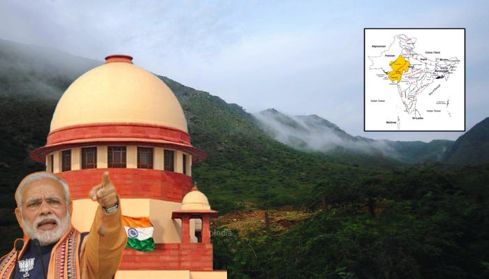
Opposition’s fear mongering Vs reality in the Aravalli Hills: Union Environment Minister Bhupender Yadav debunks false claims and lies
The Aravalli Hills, one of the world’s oldest mountain ranges extending about 700 km across the states of Gujarat, Rajasthan and Delhi, have long been at the heart of environmental debates over urban encroachment, illegal mining and deforestation. A fresh controversy has erupted over a Supreme Court ruling, which adopted a uniform definition for the Aravalli Hills. This definition was proposed by the Central government’s Ministry of Environment, Forest and Climate Change (MOEFCC). Aravalli Hills: Older than the Himalayas, a protective shield against desertification, home to diverse flora and fauna and an overall life-giver The Aravalli is not merely a range of hills but is among the oldest mountain ranges in the world. It formed years before the mighty Himalayas. The geological evidence shows that the Aravalli is approximately 2.5 billion years old. This was during the Earth’s early Precambrian era, when these hills were born. In contrast, the Himalayas are a relatively young mountain range, formed approximately 50-60 million years ago by the collision of the Indian and Eurasian tectonic plates. The Aravalli range is approximately 670–692 km long, originating in Gujarat and extending through Rajasthan, Haryana, and Delhi. Guru Shikhar (1,722 m) in Mount Abu is its highest peak. The Delhi Ridge, often referred to as the capital’s “green wall” or “green lungs,” is also an extension of the Aravalli Range. In the absence of the Aravalli Hills, which acts as a natural barrier between the Thar Desert and the fertile Indo-Gangetic plains, the Thar Desert in Rajasthan could gradually expand eastward, reaching Haryana, Delhi, and western Uttar Pradesh. Due to this, the Aravallis are considered a natural shield against desertification. Besides, the Aravalli Hills also regulate the movement of hot winds, preventing extreme temperature fluctuations and maintaining balanced rainfall. Furthermore, the Aravallis are significant for biodiversity conservation. Pertinently, the Aravalli range also plays a key role in maintaining groundwater levels. The structure of its rocks and soil allows rainwater to percolate underground. This recharges groundwater, keeping wells, stepwells, and tubewells filled for long periods of time. Many life-giving rivers like the Chambal, Sabarmati, and Luni originate in the Aravalli range. The Aravalli range is also mineral-rich, having sandstone, limestone, marble, and granite, as well as lead, zinc, copper, gold, and tungsten in abundance. Due to the presence of a vast treasury of such natural resources, the Aravalli Hills have been a target of illegal miners and mining mafias. The illegal activities of sand and stone miners have caused significant damage, including increased air pollution, destroyed forests, and reduced rainwater infiltration. Alarmingly, groundwater levels have depleted rapidly, and the ecological balance has suffered disturbance. The revised definition of the Aravalli Hills, the Supreme Court ruling and the controversy On 20th November, a Supreme Court bench comprising CJI BR Gavai, Justice K Vinod Chandran, and Justice NV Anjaria stated that allowing new mining activities without a scientific assessment by an expert body like the Indian Council of Forestry Research and Education (ICFRE) would not be in the interest of the environment and ecology. The court said that only after the Management Plan for Sustainable Mining (MPSM) is formulated will it be decided which areas are feasible to mine and which areas require protection. Excerpt taken from the relevant court order The revised definition of the Aravalli Hills is, “Any landform located in the Aravalli districts, having an elevation of 100 metres or more from the local relief, shall be termed as Aravalli Hills. Meanwhile, the definition of Aravalli Range is, “Two or more Aravalli Hills, as defined above, located within the proximity of 500m from each other, measured from the outermost point on the boundary of the lowest contour line on either side forms Aravalli Range.” In the same ruling, the court approved the operational definition of Aravalli given by the Ministry of Environment. The Supreme Court-adopted definition classifies an Aravalli Hill as a landform rising 100 meters or more above the surrounding local relief. The relief is the baseline elevation of nearby valleys or plains. The apex court also directed the Central government to carefully map the region and prepare an MPSM. This plan is supposed to include rules on designated locations and regulations of mining. The motive behind preparing this plan is to set aside confusion created by various government records and maps, as such confusion has previously led to disputes and court cases. The court directed the central government to identify mining-prone areas, environmentally sensitive zones, and areas where mining should be prohibited. It also issued directives for a post-mining rehabilitation and restoration p

The Aravalli Hills, one of the world’s oldest mountain ranges extending about 700 km across the states of Gujarat, Rajasthan and Delhi, have long been at the heart of environmental debates over urban encroachment, illegal mining and deforestation. A fresh controversy has erupted over a Supreme Court ruling, which adopted a uniform definition for the Aravalli Hills. This definition was proposed by the Central government’s Ministry of Environment, Forest and Climate Change (MOEFCC).
Aravalli Hills: Older than the Himalayas, a protective shield against desertification, home to diverse flora and fauna and an overall life-giver
The Aravalli is not merely a range of hills but is among the oldest mountain ranges in the world. It formed years before the mighty Himalayas. The geological evidence shows that the Aravalli is approximately 2.5 billion years old. This was during the Earth’s early Precambrian era, when these hills were born. In contrast, the Himalayas are a relatively young mountain range, formed approximately 50-60 million years ago by the collision of the Indian and Eurasian tectonic plates.
The Aravalli range is approximately 670–692 km long, originating in Gujarat and extending through Rajasthan, Haryana, and Delhi. Guru Shikhar (1,722 m) in Mount Abu is its highest peak. The Delhi Ridge, often referred to as the capital’s “green wall” or “green lungs,” is also an extension of the Aravalli Range.

In the absence of the Aravalli Hills, which acts as a natural barrier between the Thar Desert and the fertile Indo-Gangetic plains, the Thar Desert in Rajasthan could gradually expand eastward, reaching Haryana, Delhi, and western Uttar Pradesh. Due to this, the Aravallis are considered a natural shield against desertification.
Besides, the Aravalli Hills also regulate the movement of hot winds, preventing extreme temperature fluctuations and maintaining balanced rainfall. Furthermore, the Aravallis are significant for biodiversity conservation.
Pertinently, the Aravalli range also plays a key role in maintaining groundwater levels. The structure of its rocks and soil allows rainwater to percolate underground. This recharges groundwater, keeping wells, stepwells, and tubewells filled for long periods of time. Many life-giving rivers like the Chambal, Sabarmati, and Luni originate in the Aravalli range.
The Aravalli range is also mineral-rich, having sandstone, limestone, marble, and granite, as well as lead, zinc, copper, gold, and tungsten in abundance. Due to the presence of a vast treasury of such natural resources, the Aravalli Hills have been a target of illegal miners and mining mafias. The illegal activities of sand and stone miners have caused significant damage, including increased air pollution, destroyed forests, and reduced rainwater infiltration. Alarmingly, groundwater levels have depleted rapidly, and the ecological balance has suffered disturbance.
The revised definition of the Aravalli Hills, the Supreme Court ruling and the controversy
On 20th November, a Supreme Court bench comprising CJI BR Gavai, Justice K Vinod Chandran, and Justice NV Anjaria stated that allowing new mining activities without a scientific assessment by an expert body like the Indian Council of Forestry Research and Education (ICFRE) would not be in the interest of the environment and ecology. The court said that only after the Management Plan for Sustainable Mining (MPSM) is formulated will it be decided which areas are feasible to mine and which areas require protection.

The revised definition of the Aravalli Hills is, “Any landform located in the Aravalli districts, having an elevation of 100 metres or more from the local relief, shall be termed as Aravalli Hills.
Meanwhile, the definition of Aravalli Range is, “Two or more Aravalli Hills, as defined above, located within the proximity of 500m from each other, measured from the outermost point on the boundary of the lowest contour line on either side forms Aravalli Range.”
In the same ruling, the court approved the operational definition of Aravalli given by the Ministry of Environment. The Supreme Court-adopted definition classifies an Aravalli Hill as a landform rising 100 meters or more above the surrounding local relief. The relief is the baseline elevation of nearby valleys or plains.
The apex court also directed the Central government to carefully map the region and prepare an MPSM. This plan is supposed to include rules on designated locations and regulations of mining. The motive behind preparing this plan is to set aside confusion created by various government records and maps, as such confusion has previously led to disputes and court cases.
The court directed the central government to identify mining-prone areas, environmentally sensitive zones, and areas where mining should be prohibited. It also issued directives for a post-mining rehabilitation and restoration plan.
Importantly, the court rejected the demand of a blanket mining ban in the entire Aravalli range, saying that this could encourage illegal mining.
The top court’s ruling aimed to resolve inconsistencies in how states defined the Aravallis, which arose from a 1992 SC ban on mining in the Hills.
Unsurprisingly, however, the opposition parties have stirred a controversy alleging that the new definition excludes 90% of the hills and opens doors for large-scale mining, real-estate development and non-forest activities. They claim that such activities would destroy the Aravalli Hills and Ranges and exacerbate pollution in the National Capital Region (NCR) since the Aravallis act as a natural shield against desert sands and dust from Rajasthan and aid groundwater recharge.
Genuine concerns and confusions were clouded by political rhetoric, fear-mongering and false narratives.
The first major political voice to stoke fear about the future of the Aravalli Hills was Congress leader Sonia Gandhi, who wro$te an op-ed in The Hindu on 3rd December. Gandhi claimed that the Modi government has “signed a death warrant” for the Aravalli hills. The senior Congress leader further claimed that hills not under the 100 metres elevation will not be protected against mining and thus, 90% of the Aravalli Hills will be opened for illegal miners and mafias.
“The Modi Government has now nearly signed a death warrant for these hills, already denuded by illegal mining. It has declared that any hills in the range with an elevation of less than 100 metres are not subject to the strictures against mining. It is an open invitation for illegal miners and mafias to finish off 90% of the range which falls below the height limit set by the Government,” Sonia Gandhi wrote.

Similarly, Congress leader Jairam Ramesh posted on X last month, “…This definition is meant to restrict mining but in reality will mean that 90% of the Aravalli Hills will not be counted as Aravalli any more. Evidently, the Supreme Court has accepted this revised definition. This is bizarre and will have very grave environmental and public health consequences. It calls for an immediate review. The road to hell is indeed paved with good intentions.”
The Aravalli Hills extend from Delhi through Haryana and Rajasthan to Gujarat. Over the years they have been devastated by mining, construction, and other activities in violation of all regulations and laws.
— Jairam Ramesh (@Jairam_Ramesh) November 27, 2025
Now it appears that this sensitive and sprawling ecosystem will be… pic.twitter.com/bmUI9pitN7
The outrage against the revised definition channelled into a social media hashtag #SaveAravalli. The emotionally-charged and fearmongering-riddled posts under this campaign portray the entire situation as if the Central government is going to runover bulldozers on the Aravalli Hills overnight.
PM Modi doesn’t give a damn about pollution or the health risks it poses
— Supriya Shrinate (@SupriyaShrinate) December 2, 2025
His govt has redefined Aravallis. As a consequence 90% of the range, which is under 100 metres in height will now be mined recklessly
Aravallis are crucial to clean air in NCR
pic.twitter.com/JfeLpBLBDr
Leftist propaganda portal The Wire also jumped the bandwagon and cited environmentalists to claim that the “new re-definition of the Aravallis is disastrous for the hill range chiefly because of the impacts on people, biodiversity and the ecosystem due to the opening of vast tracts of the Aravallis to mining.”
The Modi government refutes false narratives aimed at stoking fear about the future of the Aravalli Hills
The controversy around the Supreme Court ruling adopting the revised definition of the Aravalli Hills has been amplified by a section of social media influencers and opposition-aligned propagandists under the #SaveAravalli trend. It is being claimed that the revised definition will somehow allow the government and real-estate giants to ‘massacre’ 90% of hills by colliding for their own lucrative interests.

However, beyond the opposition’s outcry and fearmongering, the truth is that neither the Aravalli Hills is going to be handed over to illegal mining mafias nor 90% of the hills is going to lose their “Aravalli” status.
The claims of dilution of protections are alarmist and misinterpretations. In a detailed statement, the MoEFCC stated the Supreme Court-mandated uniform definition does not relax or remove mining bans; rather, it enforces stricter, landscape-level conservation across states.
In contrast with one of the major talking points of the opposition and its supportive ecosystem, the 100-metre rule, the government says that this rule refers to elevation above local relief and not the top 100 meters of hills.
Notably, only the state of Rajasthan had a formally established Aravalli definition based on the 2002 Committee Report of the State Government, relying on Richard Murphy’s landform classification, which identified all landforms rising 100 m above local relief as hills and, based on that, prohibited mining on both the hills and their supporting slopes. Rajasthan has been following this definition since 9th January 2006.
When deliberations were held regarding the definition of the Aravallis, all relevant states agreed to the Richard Murphy definition, that is, the uniform criterion of “100 metres above local relief” for regulating mining in the Aravalli region.
Essentially, the government says that all the landforms enclosed within the lowest binding contour encircling Hills of height 100 metres or more, irrespective of their height and slopes, are excluded from the grant of a mining lease. Similarly, the Aravalli range has been explained as all the landforms which exist within 500 metres of two adjoining Hills of height 100 metres or more.
The Central government states that all landforms existing within this 500-metre zone, irrespective of their height and slope, are excluded from the grant of mining lease.
“It is, therefore, wrong to conclude that mining is permitted in all landforms below 100 metre height,” the MoEFCC stated.
भ्रम फैलाना बंद करें!
— Bhupender Yadav (@byadavbjp) December 21, 2025
अरावली के कुल 1.44 लाख वर्ग किलोमीटर क्षेत्र में मात्र 0.19% हिस्से में ही खनन की पात्रता हो सकती है।
बाकी पूरी अरावली संरक्षित और सुरक्षित है।#AravalliIsSafe pic.twitter.com/ojbaqtlniG
In a conversation with news agency ANI, Union Environment Minister Bhupendra Yadav highlighted the globally accepted Richard Murphy definition of hills.
“The Supreme Court said two things in its judgment that people are hiding. First, in the very first paragraph, it praised the Ministry of Environment and Forests’ Green Aravalli Wall movement. Second, it asked, what is included in the Aravalli Hills and Aravalli Range? So, geologists around the world accept a standard definition given by Richard Murphy that a hill 100 meters high is considered a mountain. Its height alone does not define it as a mountain. The entire 100 meters, from the height to the ground level, is protected… 90 percent of the area is protected…” Minister Yadav said.
Simply put, the definition of Aravalli Hill as any landform rising 100 metres or more above local relief, along with their supporting slopes, the whole ecological unit is protected. No mining or non-forest activities will be allowed there. Since slopes are crucial for soil stability, water recharge, and vegetation cover, slopes or foothills would be protected against piecemeal exploitation.
The revised definition treats the Aravallis as a continuous geological ridge, thus protecting the entire landscape and not just isolated hills.
“Hills within 500 metres proximity are grouped into Aravalli Ranges. This ensures that valleys, intervening slopes, and smaller hillocks between major peaks are also safeguarded. Ecologically, this protects connectivity of habitats, wildlife corridors, and the integrity of the ridge system,” the MoEFCC stated.
The government has also made it clear that until the finalisation of the MPSM through ICFRE is completed, no new mining leases shall be permitted. In future, all mining would be permitted as per the MPSM only in those areas where sustainable mining could be permitted.
In fact, even after the MPSM is finalised, mining activity will be permitted only in 0.10% of the area. The allegations that the Central government is promoting mining is also not true since more than 90% of the area will remain protected and free from any mining or broader non-forest activity.

“Mining activity in the Aravalli Range will be allowed only in 0.19 percent of the area, which is less than one percent, and even there no new mines have been opened… The process has been made more stringent. The main problem in the Aravalli Range is illegal mining. To prevent illegal mining, the Supreme Court has given this definition, which is still pending review. With this broad definition and strict provisions, 90 percent of the area is completely protected,” Minister Yadav said.
Pertinently, since the revised definition in question is only operational, the Supreme Court has ordered no new mining leases, ensuring a preventive shield against immediate ecological threats.
In addition, mining remains fully prohibited in protected areas, eco-sensitive zones, tiger reserves, wetlands, and CAMPA plantation sites.
Addressing the concerns over illegal mining activities, the government said that multiple measures, including surveillance with drones, CCTV, weighbridges, and district task forces, are being deployed to prevent illegal activities.
The Modi government maintains that there is no threat to the ecology of the older-than-memory Aravallis. “Contrary to alarmist claims, there is no imminent threat to the Aravallis’ ecology. Ongoing afforestation, eco-sensitive zone notifications, and strict monitoring of mining and urban activities ensure that the Aravallis continue to serve as a natural heritage and ecological shield for the nation. India’s resolve is clear: the Aravallis will be safeguarded for present and future generations while balancing conservation with responsible development,” the government said.